Plenary Lecture
Computational Intelligence-Based Algorithms for Data Mining of Earth Observation Imagery

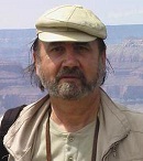
Professor Victor-Emil Neagoe
Polytechnic University of Bucharest
Romania
E-mail: victoremil@gmail.com
Abstract: Data mining of Earth Observation (EO) imagery has wide applications for generation of various kinds of civil or military maps: maps of vegetation, maps of mineral resources of the Earth, land-use maps (buildings, airports, agricultural fields, woods, rivers, lakes, and highways), and so on. Disaster management poses also significant challenges for space data analysis, to aid management and recovery in the aftermath of natural or man-made disasters: earthquakes, tsunamis, fires, floods and similar catastrophes. We present some computational intelligence (CI)-based approaches for remote sensing image data mining. CI is inspired by biological and natural intelligence, resulting so-called„intelligent systems” (nature-inspired intelligent technological paradigms); this is dealing with Artificial Neural Networks, Swarm Intelligence, Evolutionary Computing, and so on. Experimental results of the developed and implemented CIbased algorithms by the speaker team for multispectral EO image classification and for change detection in time-series of satellite images are given.
Brief Biography of the Speaker: Dr. Victor-Emil Neagoe is a Professor of the Polytechnic University of Bucharest, Romania, where he currently teaches courses of pattern recognition and artificial intelligence; data mining; computational intelligence; digital signal processing; detection, estimation and information processing. He has over 45 years of experience in university teaching and research. He has been a Ph.D. supervisor since 1990; some of his former Ph. D. students are prestigious senior researchers in Romania, USA, Canada, U.K., France, Germany. Prof. Neagoe has published more than 150 papers, 40 of them ISI Thomson coted. His research experience includes: pattern recognition, image processing, data mining, computational intelligence, multispectral and hyperspectral satellite/aerial image analysis, image compression and recognition, computer vision, biometrics, sampling theory. Prof. Neagoe has been included in Who’s Who in the World 2011, 2012, 2013, 2014, 2015 (28th-32nd Editions), as well as in Who’s Who in Science and Engineering: 2005-2006, (8th Edition) and 2011-2012 (11th Edition).